Daha B�y�k G�r�nt�le
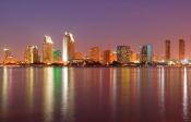
California (Listeni/ˌk�ləˈfɔrnjə/) is a state located on the West Coast of the United States. It is by far the most populous U.S. state,[15] and the third most extensive (after Alaska and Texas). It is home to the nation's 2nd and 6th largest census statistical areas (Los Angeles metropolitan area and San Francisco Bay Area, respectively), and eight of the nation's fifty most populated cities (Los Angeles, San Diego, San Jose, San Francisco, Fresno, Sacramento, Long Beach and Oakland).[16] The capital city is Sacramento.
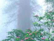
California's diverse geography ranges from the Pacific Coast in the west, to the Sierra Nevada mountains in the east � from the Redwood�Douglas-fir forests of the northwest, to the Mojave Desert areas in the southeast. The center of the state is dominated by Central Valley, a major agricultural area. California contains both the highest and lowest points in the contiguous United States (Mount Whitney and Death Valley), and has the 3rd longest coastline of all states (after Alaska and Florida). Earthquakes are a common occurrence due to the state's location along the Pacific Ring of Fire: about 37,000 are recorded annually.[17]
The name California once referred to a large area of North America claimed by Spain that included much of modern-day Southwestern United States and the Baja California peninsula. Beginning in the late 18th century, the area known as Alta California, comprising the California territory north of the Baja Peninsula, was colonized by the Spanish Empire as part of New Spain. In 1821, Alta California became a part of Mexico following its successful war for independence. Shortly after the beginning of the Mexican-American War in 1846, a group of American settlers in Sonoma declared an independent California Republic in Alta California. Though its existence was short-lived, its flag became the precursor for California's current state flag. American victory in the war led to the Treaty of Guadalupe Hidalgo, in which Mexico ceded Alta California to the United States. Western areas of Alta California became the state of California, which was admitted as the 31st state on September 9, 1850.
The California Gold Rush beginning in 1848 led to dramatic social and demographic change, with large scale immigration from the U.S. and abroad and an accompanying economic boom. Key developments in the early 20th century included the emergence of Los Angeles as the center of the American entertainment industry, and the growth of a large, state-wide tourism sector. The late 20th century saw the development of the technology and information sectors, punctuated by the growth of Silicon Valley. California's prosperous agricultural industry also emerged; at least half of the fresh fruit produced in the United States are now cultivated in California, and the state also leads in the production of vegetables.[18] Other important contributors to its economy include aerospace, education, and manufacturing. If California were a country, it would have the 8th largest economy in the world[19] and it would be the 34th most populous nation.
Etymology
Main article: Origin of the name California
The word California originally referred to the entire region composed of the Baja California peninsula of Mexico, the current U.S. states of California, Nevada, and Utah, and parts of Arizona, New Mexico, and Wyoming.
The name California is most commonly believed to have derived from a fictional paradise peopled by Black Amazons and ruled by Queen Calafia.[20][21] The story of Calafia is recorded in a 1510 work The Adventures of Esplandi�n, written as a sequel to Amadis de Gaula by Spanish adventure writer Garci Rodr�guez de Montalvo.[22][23][24] The kingdom of Queen Calafia, according to Montalvo, was said to be a remote land inhabited by griffins and other strange beasts, and rich in gold.
Know ye that at the right hand of the Indies there is an island called California, very close to that part of the Terrestrial Paradise, which was inhabited by black women without a single man among them, and they lived in the manner of Amazons. They were robust of body with strong passionate hearts and great virtue. The island itself is one of the wildest in the world on account of the bold and craggy rocks.
� Chapter CLVII of The Adventures of Esplandi�n[25]
The name California is the fifth oldest surviving European place-name in the US and was applied to what is now the southern tip of Baja California peninsula as the Island of California by a Spanish expedition led by Diego de Becerra and Fort�n Xim�nez, who landed there in 1533 at the behest of Hern�n Cort�s.[note 1]
Geography
Main article: Geography of California
A topographic map of California
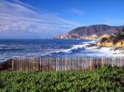
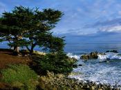
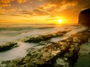
A view of the Pacific coast in Big Sur
Aerial view of the California Central Valley
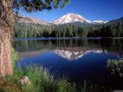
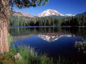
Yosemite National Park
California adjoins the Pacific Ocean to the west, Oregon to the north, Nevada and Arizona to the east, and the Mexican state of Baja California to the south. With an area of 160,000 square miles (414,000 km2), it is the 3rd largest state in the United States in size, after Alaska and Texas.[27] If it were a country, California would be the 59th-largest in the world in area.
In the middle of the state lies the California Central Valley, bounded by the coastal mountain ranges in the west, the Sierra Nevada to the east, the Cascade Range in the north and the Tehachapi Mountains in the south. The Central Valley is California's agricultural heartland and grows approximately one-third of the nation's food.[28][29]
Divided in two by the Sacramento-San Joaquin River Delta, the northern portion, the Sacramento Valley serves as the watershed of the Sacramento River, while the southern portion, the San Joaquin Valley is the watershed for the San Joaquin River; both areas derive their names from the rivers that transit them. With dredging, the Sacramento and the San Joaquin Rivers have remained sufficiently deep that several inland cities are seaports.
The Sacramento-San Joaquin River Delta serves as a critical water supply hub for the state. Water is routed through an extensive network of canals and pumps out of the delta, that traverse nearly the length of the state, including the Central Valley Project and the State Water Project. Water from the Delta provides drinking water for nearly 23 million people, almost two-thirds of the state's population, and provides water to farmers on the west side of the San Joaquin Valley. The Channel Islands are located off the southern coast.
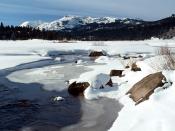
The Sierra Nevada (Spanish for "snowy range") includes the highest peak in the contiguous forty-eight states, Mount Whitney, at 14,505 ft (4421 m).[9][10][11] The range embraces Yosemite Valley, famous for its glacially carved domes, and Sequoia National Park, home to the giant sequoia trees, the largest living organisms on Earth, and the deep freshwater lake, Lake Tahoe, the largest lake in the state by volume.
To the east of the Sierra Nevada are Owens Valley and Mono Lake, an essential migratory bird habitat. In the western part of the state is Clear Lake, the largest freshwater lake by area entirely in California. Though Lake Tahoe is larger, it is divided by the California/Nevada border. The Sierra Nevada falls to Arctic temperatures in winter and has several dozen small glaciers, including Palisade Glacier, the southernmost glacier in the United States.
About 45 percent of the state's total surface area is covered by forests,[30] and California's diversity of pine species is unmatched by any other state. California contains more forestland than any other state except Alaska. Many of the trees in the California White Mountains are the oldest in the world; one Bristlecone pine has an age of 4,700 years.
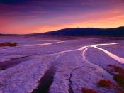
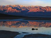
In the south is a large inland salt lake, the Salton Sea. The south-central desert is called the Mojave; to the northeast of the Mojave lies Death Valley, which contains the lowest and hottest place in North America, the Badwater Basin at −282 feet (−86.0 m).[13] The horizontal distance from the nadir of Death Valley to the summit of Mount Whitney is less than 90 miles (140 km). Indeed, almost all of southeastern California is arid, hot desert, with routine extreme high temperatures during the summer. The southeastern border of California with Arizona is entirely formed by the Colorado River, from which the southern part of the state gets about half of its water.
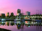
Along the California coast are several major metropolitan areas, including Greater Los Angeles Area, the San Francisco Bay Area, and the San Diego metropolitan area.
As part of the Ring of Fire, California is subject to tsunamis, floods, droughts, Santa Ana winds, wildfires, landslides on steep terrain, and has several volcanoes. It sees numerous earthquakes due to several faults, in particular the San Andreas Fault.
Climate
Main article: Climate of California
Snow on the mountains of California
Death Valley, in the desert regions of Eastern California
California's climate varies from Mediterranean to subarctic.
Much of the state has a Mediterranean climate, with cool, rainy winters and dry summers. The cool California Current offshore often creates summer fog near the coast. Farther inland, one encounters colder winters and hotter summers.
Northern parts of the state average higher annual rainfall than the south. California's mountain ranges influence the climate as well: some of the rainiest parts of the state are west-facing mountain slopes. Northwestern California has a temperate climate, and the Central Valley has a Mediterranean climate but with greater temperature extremes than the coast. The high mountains, including the Sierra Nevada, have an alpine climate with snow in winter and mild to moderate heat in summer.
The east side of California's mountains produce a rain shadow, creating expansive deserts. The higher elevation deserts of eastern California see hot summers and cold winters, while the low deserts east of the southern California mountains experience hot summers and nearly frostless mild winters. Death Valley, a desert with large expanses below sea level, is considered the hottest location in North America; the highest temperature in the Western Hemisphere, 134 �F (57 �C), was recorded there on July 10, 1913. The lowest temperature in California was −45 �F in 1937 in Boca.
Ecology
Main article: Ecology of California
California is one of the richest and most diverse parts of the world, and includes some of the most endangered ecological communities. California is part of the Nearctic ecozone and spans a number of terrestrial ecoregions.[31]
California's large number of endemic species includes relict species, which have died out elsewhere, such as the Catalina Ironwood (Lyonothamnus floribundus). Many other endemics originated through differentiation or adaptive radiation, whereby multiple species develop from a common ancestor to take advantage of diverse ecological conditions such as the California lilac (Ceanothus). Many California endemics have become endangered, as urbanization, logging, overgrazing, and the introduction of exotic species have encroached on their habitat.
Flora and fauna
California boasts several superlatives in its collection of flora: the largest trees, the tallest trees, and the oldest trees. California's native grasses are perennial plants.[32] After European contact, these were generally replaced by invasive species of European annual grasses; and, in modern times, California's hills turn a characteristic golden-brown in summer.[33]
Because California has the greatest diversity of climate and terrain, the state has six life zones which are the lower Sonoran (desert); upper Sonoran (foothill regions and some coastal lands), transition (coastal areas and moist northeastern counties); and the Canadian, Hudsonian, and Arctic Zones, comprising the state's highest elevations.[34]
Plant life in the dry climate of the lower Sonoran zone contains a diversity of native cactus, mesquite, and paloverde. The Joshua tree is found in the Mojave Desert. Flowering plants include the dwarf desert poppy and a variety of asters. Fremont cottonwood and valley oak thrive in the Central Valley. The upper Sonoran zone includes the chaparral belt, characterized by forests of small shrubs, stunted trees, and herbaceous plants. Nemophila, mint, Phacelia, Viola, and the California poppy (Eschscholzia californica) � the state flower � also flourish in this zone, along with the lupine, more species of which occur here than anywhere else in the world.[34]
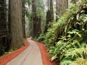
The transition zone includes most of California's forests with the redwood (Sequoia sempervirens) and the "big tree" or giant sequoia (Sequoia gigantea), among the oldest living things on earth (some are said to have lived at least 4,000 years). Tanbark oak, California laurel, Sugar Pine, madrona, broad-leaved maple, and Douglas-fir also grow here. Forest floors are covered with swordfern, alumnroot, barrenwort, and trillium, and there are tickets of huckleberry, azalea, elder, and wild currant. Characteristic wild flowers include varieties of mariposa, tulip, and tiger and leopard lilies.[35]
The high elevations of the Canadian zone allow the Jeffrey Pine, red fir, and Lodgepole Pine to thrive. Brushy areas are abundant with dwarf manzanita and ceanothus; the unique Sierra puffball is also found here. Right below the timeberline, in the Hudsonian zone, the whitebark, foxtail, and silver pines grow. At about 10,500 ft (3,200 m), begins the Arctic zone, a treeless region whose flora include a number of wildflowers, including Sierra primrose, yellow columbine, alpine buttercup, and alpine shooting star.[34][36]
Common plants that have been introduced to the state include the eucalyptus, acacia, pepper tree, geranium, and Scotch broom. The species that are federally classified as endangered are the Contra Costa wallflower, Antioch Dunes evening primrose, Solano Grass, San Clemente Island larkspur, salt marsh bird's beak, McDonald's rock-cress, and Santa Barbara Island Liveforever. As of December 1997, 85 plant species were listed as threatened or endangered.[34]
In the deserts of the lower Sonoran zone, the mammals include the jackrabbit, kangaroo rat, squirrel, and opossum. Common birds include the owl, roadrunner, Cactus Wren, and various species of hawk. The area's reptilian life include the sidewinder viper, desert tortoise, and horned toad. The upper Sonoran zone boasts mammals such as the antelope, brown-footed woodrat, and Ring-tailed cat. Birds unique to this zone are the California Thrasher, bushtit, and California Condor.[34][37][38][39]
In the transition zone, there are Colombian Black-tailed Deer, black bears, gray foxes, cougars, bobcats, and Roosevelt elk. Reptiles such as the garter snakes and rattlesnakes inhabit the zone. In addition, amphibians such as the water puppy and redwood salamander are common too. Birds such as the kingfisher, chickadee, towhee, and hummingbird thrive here as well.[34][40]
The Canadian zone mammals include the Mountain weasel, Snowshoe hare, and several species of chipmunks. Conspicuous birds include the blue-fronted jay, Sierra chickadee. Sierra Hermit Thrush, water ouzel, and Townsend's Solitaire. As one ascends into the Hudsonian zone, birds become scarcer. While the Sierra rosy finch is the only bird native to the high Arctic region, other bird species such as the hummingbird and Clark's Nutcracker. Principal mammals found in this region include the Sierra coney, White-tailed jackrabbit, and the Bighorn Sheep. As of April 2003, the Bighorn Sheep was listed as endangered by the US Fish and Wildlife Service. The fauna found throughout several zones are the mule deer, coyote, mountain lion, Northern Flicker, and several species of hawk and sparrow.[34]
Aquatic life in California thrives, from the state's mountain lakes and streams to the rocky Pacific coastline. Numerous trout species are found, among them rainbow, golden, and Tahoe. Migratory species of salmon are common as well. Deep-sea life forms include sea bass, yellowfin tuna, barracuda, and several types of whale. Native to the cliffs of northern California are seals, sea lions, and many types of shorebirds, including migratory species.[34]
As of April 2003, 118 California animals were on the federal endangered list; 181 plants were listed as endangered or threatened. Endangered animals include the San Joaquin kitfox, Point Arena mountain beaver, Pacific pocket mouse, Salt Marsh Harvest Mouse, Morro Bay kangaroo rat (and five other species of kangaroo rat), Amargosa vole, California Least Tern, California Condor, Loggerhead Shrike, San Clemente sage sparrow, San Francisco garter snake, five species of salamander, three species of chub, and two species of pupfish. Eleven butterflies are also endangered and two that are threatened are on the federal list. Among threatened animals are the coastal California Gnatcatcher, Paiute cutthroat trout, southern sea otter, and Northern Spotted Owl. California has a total of 290,821 acres (1,176.91 km2) of National Wildlife Refuges.[34] As of September 2010, 123 California animals were listed as either endangered or threatened on the federal list provided by the US Fish & Wildlife Service.[41] Also, as of the same year, 178 species of California plants were listed either as endangered or threatened on this federal list.[41]
Rivers
Main article: List of rivers of California
The vast majority of rivers in California are dammed as part of two massive water projects: the Central Valley Project, providing water to the agricultural central valley, the California State Water Project diverting water to from northern to southern California. The state's coasts, rivers, and other bodies of water are regulated by the California Coastal Commission.
The two most prominent rivers within California are the Sacramento River and the San Joaquin River, which drain the Central Valley and the west slope of the Sierra Nevada and flow to the Pacific Ocean through San Francisco Bay. Several major tributaries feed into the Sacramento and the San Joaquin, including the Pit River, the Tuolumne River, and the Feather River.
The Eel River and Salinas River each drain portions of the California coast, north and south of San Francisco Bay, respectively, and the Eel river is the largest river in the state to remain in its natural un-dammed state. The Mojave River is the primary watercourse in the Mojave Desert, and the Santa Ana River drains much of the Transverse Ranges as it bisects Southern California. Some other important rivers are the Klamath River and the Trinity River in the far north coast, and the Colorado River on the southeast border with Arizona.
Regions
for more, see List of regions of California and List of places in California.
Mount Whitney (l), the highest point in the Contiguous U.S., is less than 90 miles (140 km) away from Badwater Basin in Death Valley (r), the lowest point in North America
Central Valley
Coastal California
Northern California
Central California
San Francisco Bay Area
Sierra Nevada
Upstate California
Eastern California
Inland Empire (Also included in Southern California)
Southern California
South Coast
Greater Los Angeles Area
San Diego metropolitan area
Inland Empire
Imperial Valley
History
Main article: History of California
Mission San Diego de Alcal� drawn as it was in 1848. Established in 1769, it is the first of the California Missions established
Settled by successive waves of arrivals during the last 10,000 years, California was one of the most culturally and linguistically diverse areas in pre-Columbian North America; The Indigenous peoples of California included more than 70 distinct groups of Native Americans, ranging from large, settled populations living on the coast to groups in the interior. California groups also were diverse in their political organization with bands, tribes, villages, and on the resource-rich coasts, large chiefdoms, such as the Chumash, Pomo and Salinan. Trade, intermarriage and military alliances fostered many social and economic relationships among the diverse groups.
The first European to explore the coast as far north as the Russian River was the Portuguese Juan Rodr�guez Cabrillo in 1542. Some 37 years later English explorer Francis Drake also explored and claimed an undefined portion of the California coast in 1579. Spanish traders made unintended visits with the Manila Galleons on their return trips from the Philippines beginning in 1565.[42] Sebasti�n Vizca�no explored and mapped the coast of California in 1602 for New Spain.
Spanish missionaries began setting up 21 California Missions along the coast of what became known as Alta California (Upper California), together with small towns and presidios.
19th century
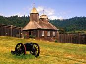
The Russians from Alaska established their largest settlement in California, Fort Ross, in 1812
San Francisco harbor c. 1850. Between 1847 and 1870, the population of San Francisco increased from 500 to 150,000
Chinese gold miners in California
In 1821 the Mexican War of Independence gave Mexico (including California) independence from Spain; for the next 25 years, Alta California remained a remote northern province of the nation of Mexico.
Cattle ranches, or ranchos, emerged as the dominant institutions of Mexican California. After Mexican independence from Spain, the chain of missions became the property of the Mexican government and were secularized by 1834.[43] The ranchos developed under ownership by Californios (Spanish-speaking Californians) who had received land grants, and traded cowhides and tallow with Boston merchants.
In 1846 settlers rebelled against Mexican rule during the Bear Flag Revolt. Afterwards, rebels raised the Bear Flag (featuring a bear, a star, a red stripe and the words "California Republic") at Sonoma. The Republic's first and only president was William B. Ide,[44] who played a pivotal role during the Bear Flag Revolt.
Beginning in the 1820s, trappers and settlers from the U.S. and Canada began to arrive in Northern California. These new arrivals used the Siskiyou Trail, California Trail, Oregon Trail and Old Spanish Trail to cross the rugged mountains and harsh deserts surrounding California. In this period, Imperial Russia explored the California coast and established a trading post at Fort Ross.
The California Republic was short lived; the same year marked the outbreak of the Mexican-American War (1846�1848). When Commodore John D. Sloat of the United States Navy sailed into Monterey Bay and began the military occupation of California by the United States, Northern California capitulated in less than a month to the U.S. forces. After a series of defensive battles in Southern California, the Treaty of Cahuenga was signed by the Californios on January 13, 1847, securing American control in California.
Following the Treaty of Guadalupe Hidalgo that ended the war, the region was divided between Mexico and the U.S.; the western territory of Alta California, was to become the U.S. state of California, and Arizona, Nevada, Colorado and Utah became U.S. Territories, while the lower region of California, the Baja Peninsula, remained in the possession of Mexico.
In 1848 the non-native population of California was estimated to be no more than 15,000. After gold was discovered, the population burgeoned with U.S. citizens, Europeans and other immigrants during the great California Gold Rush. By 1854 over 300,000 settlers had come.[45] On September 9, 1850, as part of the Compromise of 1850, California was admitted to the United States undivided as a free state, denying the expansion of slavery to the Pacific Coast.
California's native population precipitously declined, above all, from Eurasian diseases to which they had no natural immunity.[46] Like in other states, the native inhabitants were forcefully removed from their lands by incoming miners, ranchers, and farmers. And despite the fact that California entered the union as a free state, the "loitering or orphaned Indians" were de facto enslaved by Mexican and Anglo-American masters under the 1853 Act for the Government and Protection of Indians.[47] There were several massacres in which hundreds of indigenous people were killed. Between 1850 and 1860, California paid around 1.5 million dollars (some 250,000 of which was reimbursed by the federal government)[48] to hire militias whose purpose was to protect settlers from the indigenous populations. In subsequent decades, the native population was placed in reservations and rancherias, which were often very small and isolated and lacked adequate natural resources or funding from the government to sustain the populations living on them.[47] As a result, the rise of California brought great hardship for the native inhabitants. Several scholars and Native American activists, including Benjamin Madley and Ed Castillo, have described the actions of the California government as a genocide.[49]
The seat of government for California under Spanish and later Mexican rule was located at Monterey from 1777 until 1846.[43] In 1849 the Constitutional Convention was first held there. Among the duties was the task of determining the location for the new state capital. The first legislative sessions were held in San Jose (1850�1851). Subsequent locations included Vallejo (1852�1853), and nearby Benicia (1853�1854); these locations eventually proved to be inadequate as well. The capital has been located in Sacramento since 1854[50] with only a short break in 1861 when legislative sessions were held in San Francisco due to flooding in Sacramento.
Initially, travel between California and the rest of the continental U.S. was time consuming and dangerous. A more direct connection came in 1869 with the completion of the First Transcontinental Railroad through Donner Pass in the Sierra Nevada mountains. Once completed, hundreds of thousands of U.S. citizens came west, where new Californians were discovering that land in the state, if irrigated during the dry summer months, was extremely well suited to fruit cultivation and agriculture in general. Vast expanses of wheat, other cereal crops, vegetable crops, cotton, and nut and fruit trees were grown (including oranges in Southern California), and the foundation was laid for the state's prodigious agricultural production in the Central Valley and elsewhere. The large earthquake that hit San Francisco in 1906 devastated the city.[51]
20th century
Hollywood film studios, 1922
Migration to California accelerated during the early-20th century with the completion of major transcontinental highways like the Lincoln Highway and Route 66. In the period from 1900 to 1965, the population grew from fewer than one million to become the most populous state in the Union. In 1940, the Census Bureau reported California's population as 6% Hispanic, 2.4% Asian, and 89.5% non-Hispanic white.[52]
In order to meet the population's needs, major engineering feats like the California and Los Angeles Aqueducts; the Oroville and Shasta Dams; and the Bay and Golden Gate Bridges were built across the state. The state government also adopted the California Master Plan for Higher Education in 1960 to develop a highly efficient system of public education.
Meanwhile, attracted to the mild Mediterranean climate, cheap land, and the state's wide variety of geography, filmmakers established the studio system in Hollywood in the 1920s. A couple of decades later, Stanford University and its Dean of Engineering Frederick Terman began encouraging faculty and graduates to stay in California instead of leaving the state, and develop a high-tech region in the area now known as Silicon Valley.[53] As a result of these efforts, California is currently regarded as a world center of the entertainment and music industries, of technology and engineering businesses, and as the U.S. center of agricultural production.
Racial and ancestral makeup
According to the U.S. Census Bureau in 2011:[68]
74% White (40% Non-Hispanic White)
14% Asian (3% Chinese, 3% Filipino, 1.6% Vietnamese, 1.4% Indian, 1.2% Korean, 0.7% Japanese, 0.2% Hmong, 0.2% Cambodian, 0.2% Laotian, 0.1% Thai, 0.1% Pakistani)
6.6% Black or African American
2% Native American
5% Multiracial (1.3% White and "Some Other Race", 1.2% White and Asian, 0.6% White and Native American, 0.5% White and Black, 1.3% Other)
0.4% Native Hawaiian or Pacific Islander (0.1% Samoan, 0.1% Guamanian or Chamorro, 0.1% Native Hawaiian, 0.2% "Other Pacific Islander")
38% are Hispanic or Latino (of any race) (31% Mexican, 1.5% Salvadoran, 0.9% Guatemalan, 0.5% Puerto Rican, 0.3% Nicaraguan, 0.2% Honduran, 0.2% Cuban, 0.2% Colombian, 0.2% Peruvian)
The principal ancestries of California's residents in 2009 has been surveyed to be:[69]
31% Mexican
10% German
8% Irish
7% English
4% Italian
With regard to demographics, California has the largest population of White Americans in the U.S., an estimated 22,2000,000 residents, although most demographic surveys do not measure actual genetic ancestry. The state has the 5th largest population of African Americans in the U.S., an estimated 2,250,000 residents. California's Asian American population is estimated at 4.4 million, about a third of the nation's 13 million Asian Americans. California's Native American population of 285,000 is the most of any state.[70] While the population of minorities accounts for 102 million of 301 million U.S. residents, 20% of the national total live in California.[70][71]
According to estimates from 2011, California has the largest minority population in the United States by numbers, making up 60% of the state population.[55] In 2000, Hispanics comprised 32% of the population; that number grew to 38% in 2011.[72] Non-Hispanic whites decreased from 80% of the state's population in 1970 to 40% in 2011.[55][73]
The population younger than age 1 was 75% minority in 2011.[74] Approximately 26% of California's public school students in the 2011�12 school year identified themselves as white (non-Hispanic), and 52% of the state's students identified themselves as Hispanic or Latino. The following ethnic groups that made up the statewide public school student body were Asians (11%), African Americans (7%), Native Americans (0.7%), and Pacific Islanders (0.6%). Students of mixed race made up 2% of the public schools. Hispanics made up the majority of the state's public schools since 2010. Los Angeles Unified School District, the largest school district in California and second largest in the nation, is 73% Hispanic, 10% African American, 9% non-Hispanic Caucasian, 6% Asian, 0.5% Native American, and 0.4% Pacific Islander.[75]
Languages
As of 2005, 58% of California residents age five and older spoke English as a first language at home, while 28% spoke Spanish. In addition to English and Spanish, 2% spoke Filipino, 1.6% spoke Chinese (which included Cantonese [0.6%] and Mandarin [0.4%]), 1.4% spoke Vietnamese, and 1% spoke Korean as their mother tongue. In total, 42% of the population spoke languages other than English.[76][77] California was historically one of the most linguistically diverse areas in the world, and is home to more than 70 indigenous languages derived from 64 root languages in 6 language families.[78][79] About half of the indigenous languages are no longer spoken, and all of California's living indigenous languages are endangered. There are some efforts toward language revitalization, such as for the Karuk language.
The official language of California has been English since the passage of Proposition 63 in 1986.[80] However, many state, city, and local government agencies still continue to print official public documents in numerous languages.[81] For example, the California Department of Motor Vehicles offers the written exam for the standard C Class driver's license in 31 languages along with English, and the audio exam in 11 languages.[82]
Culture
Main article: Culture of California
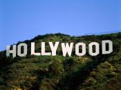
The Hollywood Sign, a symbol of the American Film industry
The culture of California is a Western culture and most clearly has its modern roots in the culture of the United States, but also, historically, many Hispanic influences. As a border and coastal state, Californian culture has been greatly influenced by several large immigrant populations, especially those from Latin America.[83]
California has long been a subject of interest in the public mind and has often been promoted by its boosters as a kind of paradise. In the early 20th century, fueled by the efforts of state and local boosters, many Americans saw the Golden State as an ideal resort destination, sunny and dry all year round with easy access to the ocean and mountains. In the 1960s, popular music groups such as The Beach Boys promoted the image of Californians as laid-back, tanned beach-goers.
The California Gold Rush of the 1850s is still seen as a symbol of California's economic style, which tends to generate technology, social, entertainment, and economic fads and booms and related busts.
Religion
Main article: Religion in California
Mission San Diego de Alcal�, one of the first Spanish missions in California
The largest religious denominations by number of adherents as a percentage of California's population in 2008 were the Catholic Church with 31 percent; Evangelical Protestants with 18 percent; and Mainline Protestants with 14 percent. Those unaffiliated with any religion represented 21 percent of the population.[84] The American Jewish Yearbook placed the total Jewish population of California at about 1,194,190 in 2006.[85]
The first priests to come to California were Roman Catholic missionaries from Spain. Roman Catholics founded 21 missions along the California coast, as well as the cities of Los Angeles and San Francisco. California continues to have a large Roman Catholic population due to the large numbers of Mexicans and Central Americans living within its borders. California has twelve dioceses and two archdioceses, the Archdiocese of Los Angeles and the Archdiocese of San Francisco, the former being the largest archdiocese in the United States.
A Pew Research Center survey revealed that California is somewhat less religious than the rest of the US: 62 percent of Californians say they are "absolutely certain" of the belief in God, while in the nation 71 percent say so. The survey also revealed 48 percent of Californians say religion is "very important," compared to 56 percent nationally.[86]
Economy
Main article: Economy of California
Gross Domestic Product of California by sector for 2008.[88]
Were California an independent country, its gross domestic product would be ranked between eighth and eleventh in the world.[89]
As of 2010, the gross state product (GSP) is about $1.9 trillion, the largest in the United States.[90] California is responsible for 13 percent of the United States' gross domestic product (GDP). As of 2010, California's GDP is larger than all but eight countries in the world (all but eleven countries by Purchasing Power Parity).[19]
In terms of jobs, the five largest sectors in California are trade, transportation, and utilities; government; professional and business services; education and health services; and leisure and hospitality. In terms of output, the five largest sectors are financial services, followed by trade, transportation, and utilities; education and health services; government; and manufacturing.[91]
California currently has the 5th highest unemployment rate in the nation at 12.5% as of January 2010 and had continued to rise, up significantly from 5.9% in 2007.[92][93]
California's economy is very dependent on trade and international related commerce accounts for approximately one-quarter of the state�s economy. In 2008, California exported $144 billion worth of goods, up from $134 billion in 2007 and $127 billion in 2006.[94] Computers and electronic products are California's top export, accounting for 42 percent of all the state's exports in 2008.[94]
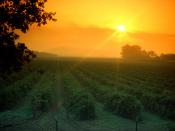
Agriculture is an important sector in California's economy. Farming-related sales more than quadrupled over the past three decades, from $7.3 billion in 1974 to nearly $31 billion in 2004.[95] This increase has occurred despite a 15 percent decline in acreage devoted to farming during the period, and water supply suffering from chronic instability. Factors contributing to the growth in sales-per-acre include more intensive use of active farmlands and technological improvements in crop production.[95] In 2008, California's 81,500 farms and ranches generated $36.2 billion products revenue.[96]
Per capita GDP in 2007 was $38,956, ranking eleventh in the nation.[97] Per capita income varies widely by geographic region and profession. The Central Valley is the most impoverished, with migrant farm workers making less than minimum wage. Recently, the San Joaquin Valley was characterized as one of the most economically depressed regions in the U.S., on par with the region of Appalachia.[98] Many coastal cities include some of the wealthiest per-capita areas in the U.S. The high-technology sectors in Northern California, specifically Silicon Valley, in Santa Clara and San Mateo counties, have emerged from the economic downturn caused by the dot-com bust.
In 2010, there were more than 663,000 millionaires in the state, more than any other state in the nation.[99]
State finances
Main articles: California state finances and 2008�12 California budget crisis
Economic regions of California
State spending increased from $56 billion in 1998 to $127 billion in 2011.[100][101] California, with 12% of the U.S. population, has one-third of the nation's welfare recipients.[102] California has the third highest per capita spending on welfare among the states, as well as the highest spending on welfare at $6.67 billion.[103] In January 2011 the California's total debt was at least $265 billion.[104]
California levies a 9.3 percent maximum variable rate income tax, with six tax brackets, collecting about $40 billion per year (representing approximately 51% of General Fund revenue and 40% of tax revenue overall in FY2007).[105] California has a state sales tax of 8.25%, which can total up to 10.75% with local sales tax included.[106] All real property is taxable annually, the tax based on the property's fair market value at the time of purchase or completion of new construction. Property tax increases are capped at 2% per year (see Proposition 13).
Infrastructure
Energy
Main article: Energy use in California
Moss Landing Power Plant, the state's largest power production source.
Because it is the most populous U.S. state, California is one of the country's largest users of energy. However because of its mild weather and strong environmental movement, its per capita energy use is one of the smallest of any U.S. state.[107] Due to the high electricity demand, California imports more electricity than any other state, primarily hydroelectric power from states in the Pacific Northwest (via Path 15 and Path 66) and coal- and natural gas-fired production from the desert Southwest via Path 46.[108]
As a result of the state's strong environmental movement, California has the some of the most aggressive renewable energy goals in the United States, with a target for California to obtain a third of its electricity from renewables by 2020.[109] Currently, several solar power plants such as the Solar Energy Generating Systems facility are located in the Mojave Desert. California's wind farms include Altamont Pass, San Gorgonio Pass, and Tehachapi Pass. Several dams across the state provide hydro-electric power.
The state�s crude oil and natural gas deposits are located in the Central Valley and along the coast, including the large Midway-Sunset Oil Field. Natural gas-fired power plants typically account for more than one-half of State electricity generation.
California is also home to two major nuclear power plants: Diablo Canyon and San Onofre. However, voters banned the approval of new nuclear power plants since the late 1970s because of concerns over radioactive waste disposal.[110][note 3] In addition, several cities such as Oakland, Berkeley and Davis have declared themselves as nuclear-free zones.
Transportation
Main article: Transportation in California
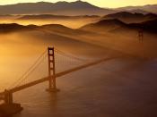
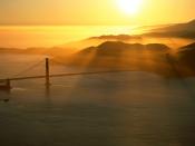
The Golden Gate Bridge in San Francisco, one of California's most famous landmarks
Caltrans builds tall "stack" interchanges with soaring ramps that offer impressive views
California's vast terrain is connected by an extensive system of controlled-access highways ('freeways'), limited-access roads ('expressways'), and highways. California is known for its car culture, giving California's cities a reputation for severe traffic congestion. Construction and maintenance of state roads and statewide transportation planning are primarily the responsibility of the California Department of Transportation, nicknamed "Caltrans". The rapidly growing population of the state is straining all of its transportation networks, and California has some of the worst roads in the United States.[112][113] The Reason Foundation's 19th Annual Report on the Performance of State Highway Systems ranked California's highways the third-worst of any state, with Alaska second, and Rhode Island first.[114]
The state has been a pioneer in road construction. One of the state's more visible landmarks, the Golden Gate Bridge, was once the longest suspension bridge main span in the world at 4,200 feet (1,300 m) when it opened in 1937. With its orange paint and panoramic views of the bay, this highway bridge is a popular tourist attraction and also accommodates pedestrians and bicyclists. The San Francisco � Oakland Bay Bridge (often abbreviated the "Bay Bridge"), completed in 1936, transports approximately 280,000 vehicles per day on two-decks. Its two sections meet at Yerba Buena Island through the world's largest diameter transportation bore tunnel, at 76 feet (23 m) wide by 58 feet (18 m) high.[115] The Arroyo Seco Parkway, connecting Los Angeles and Pasadena, opened in 1940 as the first freeway in the Western United States.[116] It was later extended south to the Four Level Interchange in downtown Los Angeles, regarded as the first stack interchange ever built.[117]
Los Angeles International Airport (the 6th busiest airport in the world) and San Francisco International Airport (the 24th busiest airport in the world) are major hubs for trans-Pacific and transcontinental traffic. There are about a dozen important commercial airports and many more general aviation airports throughout the state.
California also has several important seaports. The giant seaport complex formed by the Port of Los Angeles and the Port of Long Beach in Southern California is the largest in the country and responsible for handling about a fourth of all container cargo traffic in the United States. The Port of Oakland, fourth largest in the nation, also handles trade entering from the Pacific Rim to the rest of the country.
The California Highway Patrol is the largest statewide police agency in the United States in terms of employment with over 10,000 employees. They are responsible for providing any police-sanctioned service to anyone on California's state maintained highways and on state property.
The California Department of Motor Vehicles is by far the largest in North America. By the end of 2009, the California DMV had 26,555,006 driver's licenses and ID cards on file.[118] In 2010, there were 1.17 million new vehicle registrations in force.[119]
Intercity rail travel is provided by Amtrak California, which manages the three busiest intercity rail lines in the U.S. outside the Northeast Corridor, all of which are funded by Caltrans. This service is becoming increasingly popular over flying and ridership is continuing to set records, especially on the LAX-SFO route.[120] Integrated subway and light rail networks are found in Los Angeles (Metro Rail) and San Francisco (MUNI Metro). Light rail systems are also found in San Jose (VTA), San Diego (San Diego Trolley), Sacramento (RT Light Rail), and Northern San Diego County (Sprinter). Furthermore, commuter rail networks serve the San Francisco Bay Area (ACE, BART, Caltrain), Greater Los Angeles (Metrolink), and San Diego County (Coaster).
The California High-Speed Rail Authority was created in 1996 by the state to implement an extensive 700 mile (1127 km) rail system. Construction was approved by the voters during the November 2008 general election, a $9.95 billion state bond will go toward its construction.[121] Nearly all counties operate bus lines, and many cities operate their own city bus lines as well. Intercity bus travel is provided by Greyhound and Amtrak Thruway Coach.
In March 2011, California ranked as a top BEST state in the American State Litter Scorecard for overall effectiveness and quality of its public space cleanliness � primarily roadway litter � from state and related debris removal efforts.[122]
Water
Main article: Water in California
California's interconnected water system is the world's largest, managing over 40,000,000 acre feet of water per year, centered on six main systems of aqueducts and infrastructure projects.[123] Water use and conservation in California is a politically divisive issue, as state experiences periodic droughts and has to balance the demands of its large agricultural and urban sectors, especially in the arid southern portion of the state. The state's widespread redistribution of water also invites the frequent scorn of environmentalists.
The California Water Wars, a struggle between Los Angeles and the Owens Valley for water rights, is one of the most well-known examples of the lengths people will go to in order to secure adequate water supplies.[124] Former California Governor Arnold Schwarzenegger said: "We've been in crisis for quite some time because we're now 38 million people and not anymore 18 million people like we were in the late 60s. So it developed into a battle between environmentalists and farmers and between the south and the north and between rural and urban. And everyone has been fighting for the last four decades about water."[125]
Government and politics
State government
Main article: Government of California
The California State Capitol building in Sacramento
California is governed as a republic, with three branches of government � the executive branch consisting of the Governor and the other independently elected constitutional officers; the legislative branch consisting of the Assembly and Senate; and the judicial branch consisting of the Supreme Court of California and lower courts of California. The state also allows direct participation of the electorate by initiative, referendum, recall, and ratification. California allows each political party to choose whether to have a closed primary or a primary where only party members and independents vote. The state's capital is Sacramento.
The Governor of California and the other state constitutional officers serve four-year terms and may be re-elected only once. The California State Legislature consists of a 40-member Senate and 80-member Assembly. Senators serve four-year terms and Assembly members two. Members of the Assembly are subject to term limits of three terms, and members of the Senate are subject to term limits of two terms.
California's legal system is explicitly based upon English common law[126] (as is the case with all other states except Louisiana) but carries a few features from Spanish civil law, such as community property. Capital punishment is a legal form of punishment and the state has the largest "Death Row" population in the country (though Texas is far more active in carrying out executions). California's "Death Row" is in San Quentin State Prison situated north of San Francisco in Marin County. Executions in California are currently on hold indefinitely as human rights issues are addressed.[127] California's prison population grew from 25,000 in 1980 to over 170,000 in 2007.[128]
California's judiciary is the largest in the United States (with a total of 1,600 judges, while the federal system has only about 840). It is supervised by the seven Justices of the Supreme Court of California. Justices of the Supreme Court and Courts of Appeal are appointed by the Governor, but are subject to retention by the electorate every 12 years.
Cities, towns and counties
For lists of cities, towns, and counties in California, see List of California counties, List of largest California cities by population, List of cities and towns in California, List of California urban areas, and California locations by per capita income.
The state's local government is divided into 58 counties and 482 incorporated cities and towns; of which 460 are cities and 22 are towns. Under California law, the terms "city" and "town" are explicitly interchangeable; the name of an incorporated municipality in the state can either be "City of (Name)" or "Town of (Name)".[131]
Sacramento became California's first incorporated city on February 27, 1850.[132] San Jose, San Diego and Benicia tied for California's second incorporated city, each receiving incorporation on March 27, 1850.[133][134][135] Jurupa Valley became the state's most recent and 482nd incorporated municipality on July 1, 2011.[136][137]
The majority of these cities and towns are within one of five metropolitan areas. Sixty-eight percent of California's population lives in its three largest metropolitan areas, Greater Los Angeles Area, the San Francisco Bay Area, and the Riverside-San Bernardino Area.[citation needed] Although smaller, the other two large population centers are the San Diego and Greater Sacramento metro areas.
The state recognizes two kinds of cities: charter and general law.[131] General law cities owe their existence to state law and are consequentially governed by it; charter cities are governed by their own city charters. Cities incorporated in the 19th century tend to be charter cities. All ten of the state's most populous cities are charter cities.
Education
Torrance High School is one of the oldest high schools in continuous use in California and a popular location for television and motion picture production
Main article: Education in California
See also: List of colleges and universities in California
Public secondary education consists of high schools that teach elective courses in trades, languages, and liberal arts with tracks for gifted, college-bound and industrial arts students. California's public educational system is supported by a unique constitutional amendment that requires a minimum annual funding level for grades K-12 and community colleges that grows with the economy and student enrollment figures.[138]
California had over 6.2 million school students in the 2005�06 school year. Funding and staffing levels in California schools lag behind other states. In expenditure per pupil, California ranked 29th (of the 50 states and the District of Columbia) in 2005�06. In teaching staff expenditure per pupil, California ranked 49th of 51. In overall teacher-pupil ratio, California was also 49th, with 21 students per teacher. Only Arizona and Utah were lower.[139]
A 2007 study concluded that California's public school system was "broken".[140]
California's public postsecondary education offers a unique three tiered system:
The research university system in the state is the University of California (UC), a public university system. There are ten general UC campuses, and a number of specialized campuses in the UC system.
The California State University (CSU) system has almost 450,000 students, making it the largest university system in the United States. It is intended to accept the top one-third of high school students. The 23 CSU schools are primarily intended for undergraduate education.[141]
The California Community Colleges System provides lower division coursework as well as basic skills and workforce training. It is the largest network of higher education in the US, composed of 110 colleges serving a student population of over 2.9 million.[142]
California is also home to such notable private universities as Stanford University, the University of Southern California, the California Institute of Technology, and the Claremont Colleges. California has hundreds of other private colleges and universities, including many religious and special-purpose institutions.
Sports
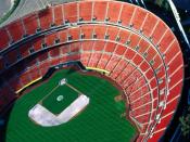
Los Angeles Memorial Coliseum, the only stadium in the world to host the Olympic Games twice: in 1932 and 1984
Main articles: Sports in California and List of professional sports teams in California
The State of California is the only US state to have hosted both the Summer and Winter Olympics. The 1932 and 1984 Summer Olympics were held in Los Angeles. Squaw Valley Ski Resort in the Lake Tahoe region hosted the 1960 Winter Olympics. Multiple games during the 1994 FIFA World Cup took place in California, with the Rose Bowl in Pasadena hosting eight matches including the final, while Stanford Stadium in Palo Alto hosted six matches.
California has nineteen major professional sports league franchises, far more than any other state. The San Francisco Bay Area has seven major league teams spread in its three major cities: San Francisco, San Jose, and Oakland. While the Greater Los Angeles Area is home to ten major league franchises, it is also the largest metropolitan area not to have a team from the National Football League. San Diego has two major league teams, and Sacramento has one. The NFL Super Bowl has been hosted in California 11 times at four different stadiums: Los Angeles Memorial Coliseum, the Rose Bowl, Stanford Stadium, and San Diego's Qualcomm Stadium.
Home to some of the most prominent universities in the United States, California has long had many respected collegiate sports programs. California is home to the oldest college bowl game, the annual Rose Bowl, among others.
California has also long been a hub for motorsports and auto racing. The city of Long Beach holds an event every year in the month of April, which is host to IndyCar Series racing through the streets of downtown. Long Beach has hosted Formula One events there in the past, and also currently hosts an event on the American Le Mans Series schedule. Auto Club Speedway is a speedway in Fontana, and currently hosts one to two NASCAR Sprint Cup Series races a year, and used to host CART Indycar races. Infineon Raceway in Sonoma is a multi-purpose facility, featuring a road course and a drag strip. The road course is home to a NASCAR event, an IndyCar event, and used to host an International Motor Sports Association sports car event. The drag strip hosts a yearly NHRA event. Mazda Raceway Laguna Seca is a roadcourse that currently hosts an ALMS event, and formerly hosted CART events. The Auto Club Raceway at Pomona has hosted NHRA drag racing for over 50 years.
Source |