Daha Büyük Görüntüle
Erzincan
Erzincan is located in Turkey
Erzincan
Coordinates: 39°44′47″N 39°29′29″ECoordinates: 39°44′47″N 39°29′29″E
Country Turkey
Province Erzincan
Government
• Mayor Yüksel Çakır (AKP)
• Kaymakam
Area
• District 1,622 km2 (626 sq mi)
Elevation 1,185 m (3,888 ft)
Population (2010)[1][2]
• Urban 102,173
• District 149,422
• District Density 92/km2 (240/sq mi)
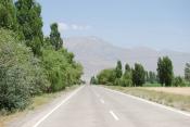
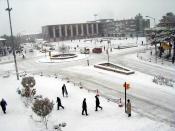
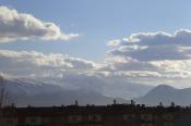
Erzincan (pronounced [eɾzinˈdʒan], also known in Byzantine sources as Celtzene and Acilisene to the Romans) is the capital of Erzincan Province in the eastern Anatolian region of Turkey. Nearby cities include Erzurum, Sivas, Tunceli, Bingöl, Elazığ, Malatya, Gümüşhane, Bayburt, and Giresun. The city is located at 39° 45' 12" North and 39° 20' 28" East, with an altitude of 1185 meters. The population is 102,173 (2010 census). Its climate produces snowy winters and warm summers.
The city is notable for handcrafted copper goods and a special cheese called "Tulum Peyniri" in Turkish. It is a significant road and rail junction and was once noted for its silverware. Current industries include sugar refining and textile industries.
The city is the headquarters of the Turkish Third Army.
History
The Erzincan valley crossed by the upper Euphrates was the location of the most important pre-Christian shrine in Armenia, dedicated to the Armenian goddess Anahit. The temple, whose site has not yet been identified, was in a settlement called Erez. The text of Agathangelos records that during the first year of his reign, King Trdat went to Erez and visited Anahit's temple to offer sacrifice. The king ordered Gregory the Illuminator, who was secretly a Christian, to make an offering at its altar. When Gregory refused he was taken captive and tortured, starting the events that would end with Trdat's conversion to Christianity some 14 years later.[3] After that conversion, during the Christianisation of Armenia, the temple at Erez was destroyed and its property and lands given to Gregory. It later became known for its extensive monasteries.
In 1071 Erzincan was absorbed into the Mengüçoğlu under the Seljuk Sulëiman Kutalmish. In 1243 it was destroyed in fighting between the Seljuks under Kaykhusraw II and the Mongols. However, by 1254 its population had recovered enough that William of Rubruck was able to say an earthquake had killed more than 10,000 people. During this period, the city reached a level of semi-independence under the rule of Armenian princes.[4]
The city was completely destroyed by a major earthquake on December 27, 1939. The earthquake of seven violent shocks, the biggest one measuring 8.2 on the Richter scale, was the most powerful one to strike Turkey in recent history. The first stage of the earthquake killed about 8,000 people. The next day, it was reported that the death toll had risen to 20,000. An emergency relief operation began. By the end of the year, 32,962 had died due to more earthquakes and several floods. So extensive was the damage to Erzincan city that its old site was entirely abandoned and a new town was founded a little further to the north.
Battle of Erzincan
Main article: Battle of Erzinjan
Caucasus Campaign of 1915 – 1916
The Battle of Erzincan took place during the Caucasus Campaign of the First World War. In 1916 Erzincan was the headquarters for the Turkish Third Army commanded by Kerim Pasha. The Russian General Nikolai Yudenich led the Russian Caucasus Army who captured Mama Hatun on 12 July 1916. They then gained the heights of Naglika and took a Turkish position on the banks of the Durum Durasi river, with their cavalry breaking through the Boz-Tapa-Meretkli line. They then advanced on Erzincan arriving by 25 June and taking the city in two days. The city was relatively untouched by battle and Yudenich seized large quantities of supplies. Despite the strategic advantages gained from this victory, Yudenich made no more significant advances and had his forces reduced due to Russian reverses further north.[5]
Colonel Kâzim Karabekir was appointed commander of the First Caucasian Army Corps. Aware of the weaknesses of the Russian Army, they marched against the remnants of the Russian Army, retaking Erzincan in February 1918.
Climate
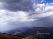
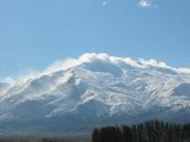
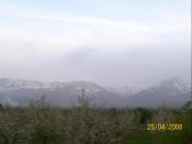
Erzincan has a continental climate (Köppen climate classification Dsa) with freezing, snowy winters and hot and very dry summers. Spring is the wettest season whilst summer is the driest.
Trivia
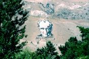
Erzincan has the largest man made of Portrait of Atatürk, located north of the city, 176m×43m. It covers 7,500 square meter. Turkish Army made it 1982, in 29 days by 3,000 soldier, 100 tons of black and white paint was used. It can be easily been seen from the 10,000m above the ground (39 47 21.93N,39 28 34.91E)
Source |